Indicative image of an offshore wind farm. North Falls’ design may differ
Onshore Cable Corridor Adjustments
A number of localised changes to the Project’s onshore cable corridor are proposed to accommodate the cable route at Little Clacton Road, south of Walton Road, north of Tendring Road and between Barlon Road and Spratts Lane.
These adjustments will also enable access to proposed temporary construction haul roads required to build the Project.
The maps shown below include a description and rationale for the temporary works relating to access to temporary construction haul roads. These works will remain in place only while the Project is being built.
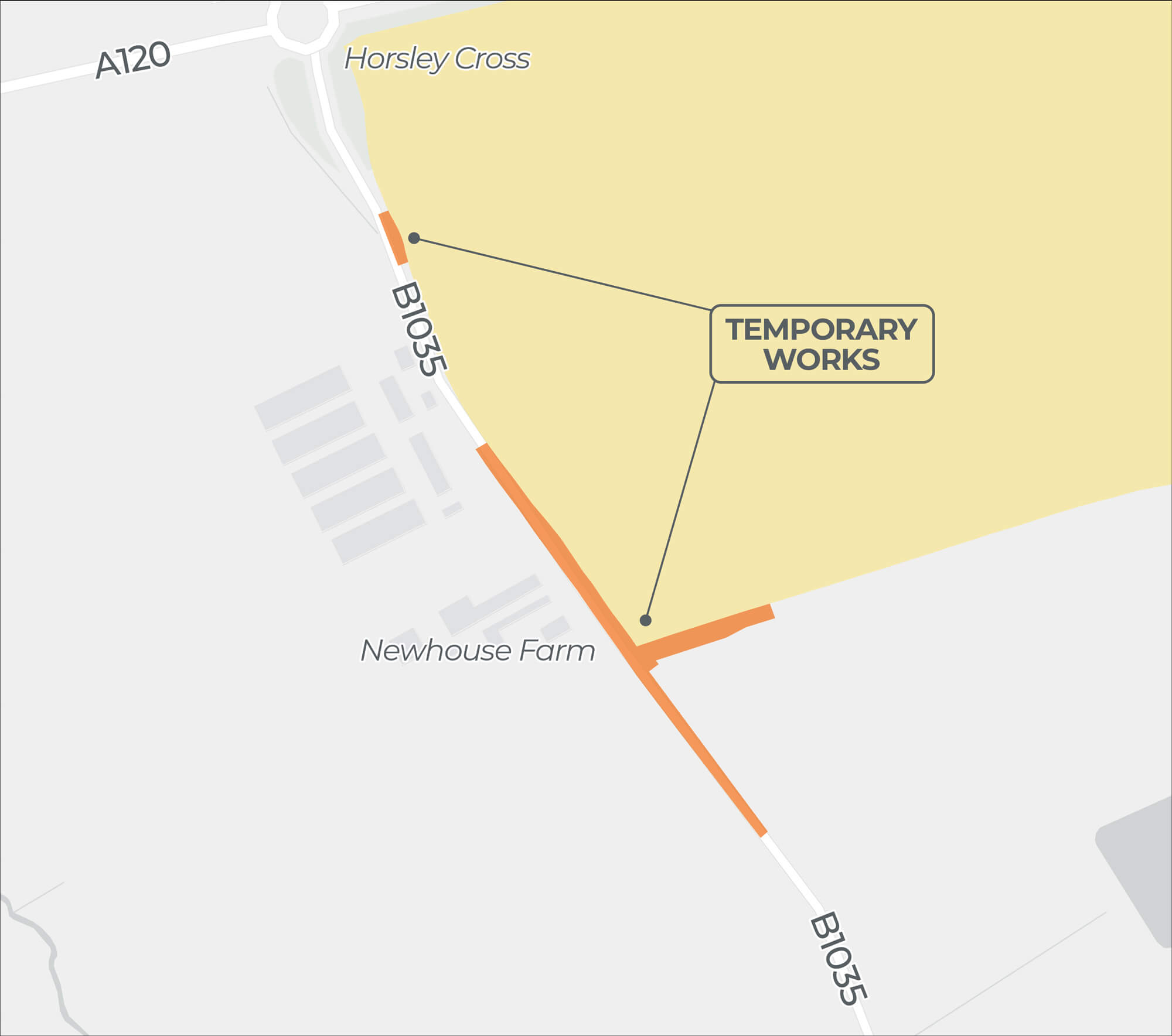
TEMPORARY WORKS RELATING TO HAUL ROADS FOR CONSTRUCTION
Click image to enlarge
Pinch to zoom
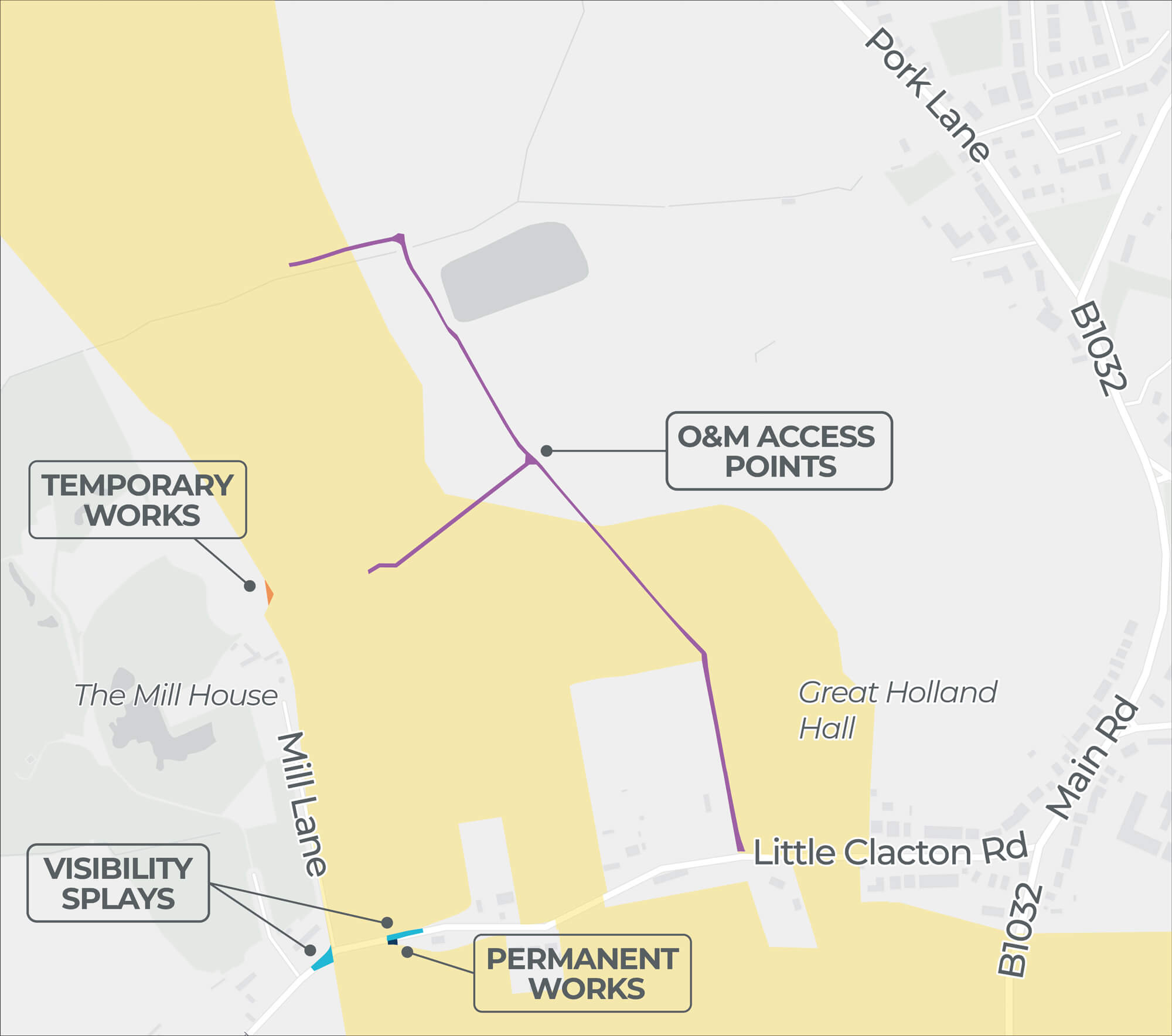
| 3 Onshore Cable Corridor Adjustment | |
|---|---|
| Location | North of Little Clacton Road. |
| Description | The temporary construction haul road needs to cross the hedgerow as far east as possible. |
| Rationale | To avoid archaeological features and target gaps in the hedgerow |
Click image to enlarge
Pinch to zoom
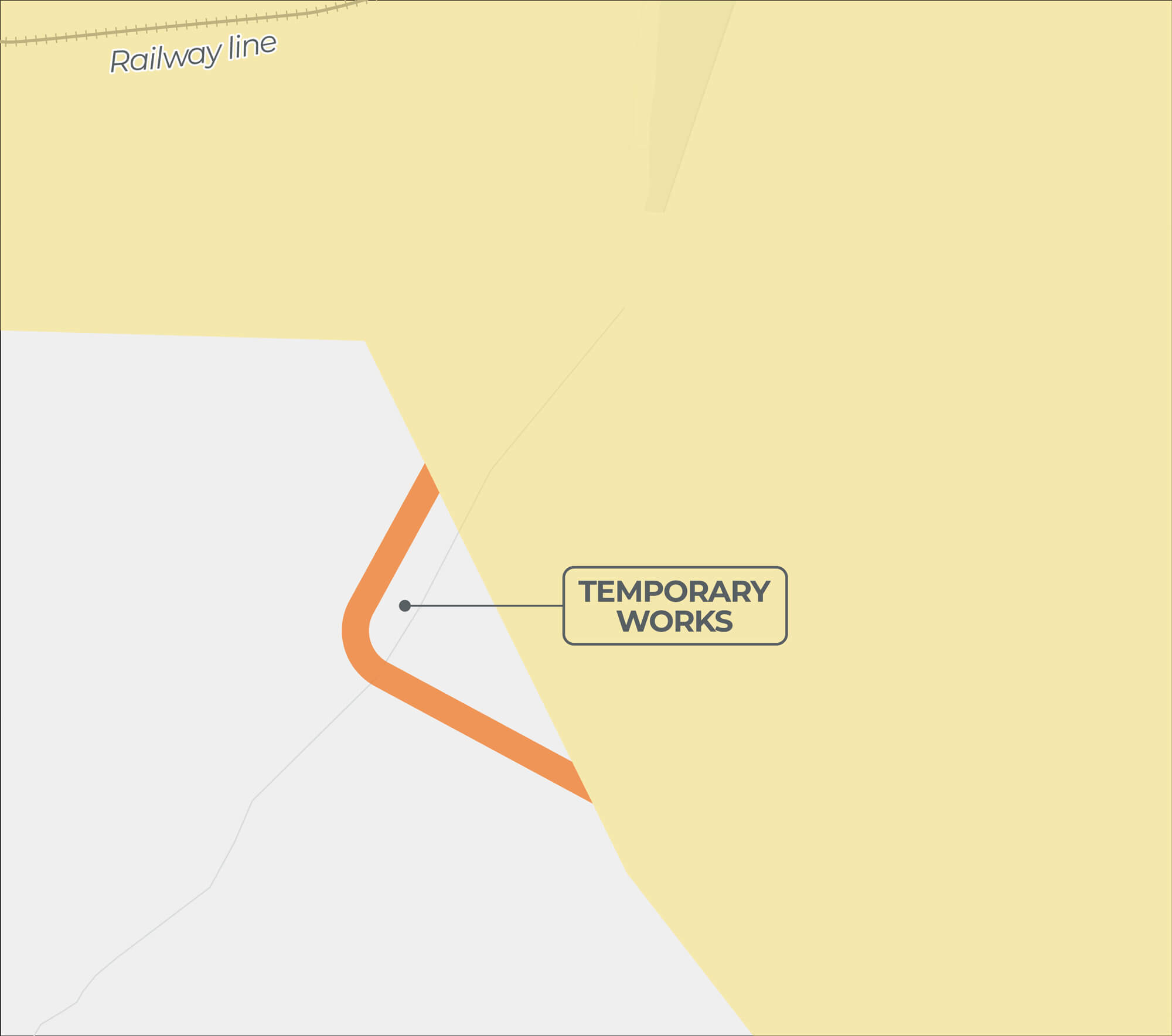
| 4 Onshore Cable Corridor Adjustment | |
|---|---|
| Location | South of Railway Line (Sunshine Coast Line). |
| Description | Temporary construction haul road crossing of watercourse required to access the onshore cable corridor. |
| Rationale | To cross a ditch at an existing culvert at an allowable shallow gradient. |
Click image to enlarge
Pinch to zoom
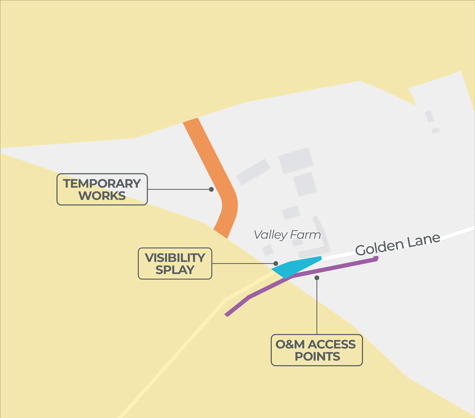
| 9 Onshore Cable Corridor Adjustment | |
|---|---|
| Location | Fields around Golden Lane. |
| Description | Temporary construction haul road around the horse paddocks near Golden Lane required to access the onshore cable corridor. |
| Rationale | To mitigate potential effects to the horse paddocks. |
Click image to enlarge
Pinch to zoom
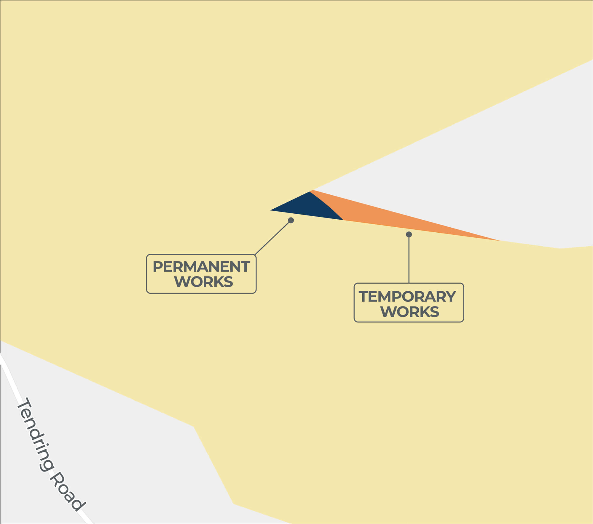
| 10 Onshore Cable Corridor Adjustment | |
|---|---|
| Location | North of Tendring Road. |
| Description | Additional section of temporary construction haul road to connect to the onshore cable corridor while avoiding the horse paddocks near Golden Lane. |
| Rationale | To better align the temporary construction haul road with the onshore cable route. |
Click image to enlarge
Pinch to zoom
| 16 Onshore Cable Corridor Adjustment | |
|---|---|
| Location | South of the A120 / B1035 roundabout. |
| Description | Access from the public highway onto the onshore cable corridor off the B1035, south of Horsley Cross. |
| Rationale | Access required off the public highway to a temporary construction compound in this area. |
Do you want to keep up to date?
Please register your contact details with us if you would like to be kept informed about our project.