Indicative image of an offshore wind farm. North Falls’ design may differ
O&M ACCESS POINTS
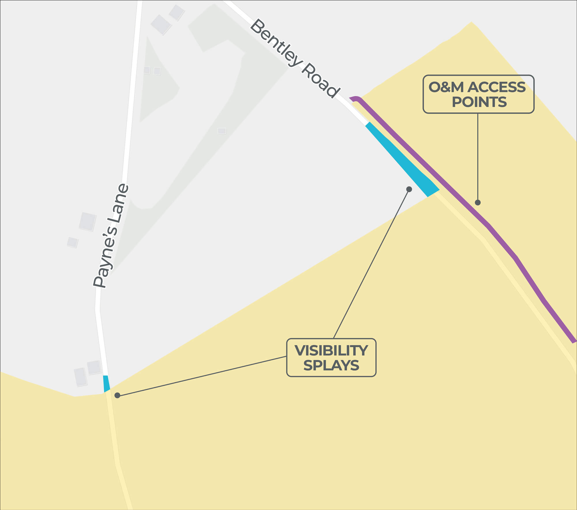
The maps on this page show 14 locations where we’ve identified O&M access points that fall outside the onshore PEIR boundary. The intention is to use existing field access points rather than accessing along the onshore cable corridor from the public highway, therefore mitigating potential effects to crops in agricultural fields. The use of O&M access points is intended to be limited to infrequent use by light vehicles in the event of emergency repairs and routine maintenance.
Glossary
Certain terms are written in green throughout this website and in our brochure. Explanations of these terms are included in an online glossary.
View glossary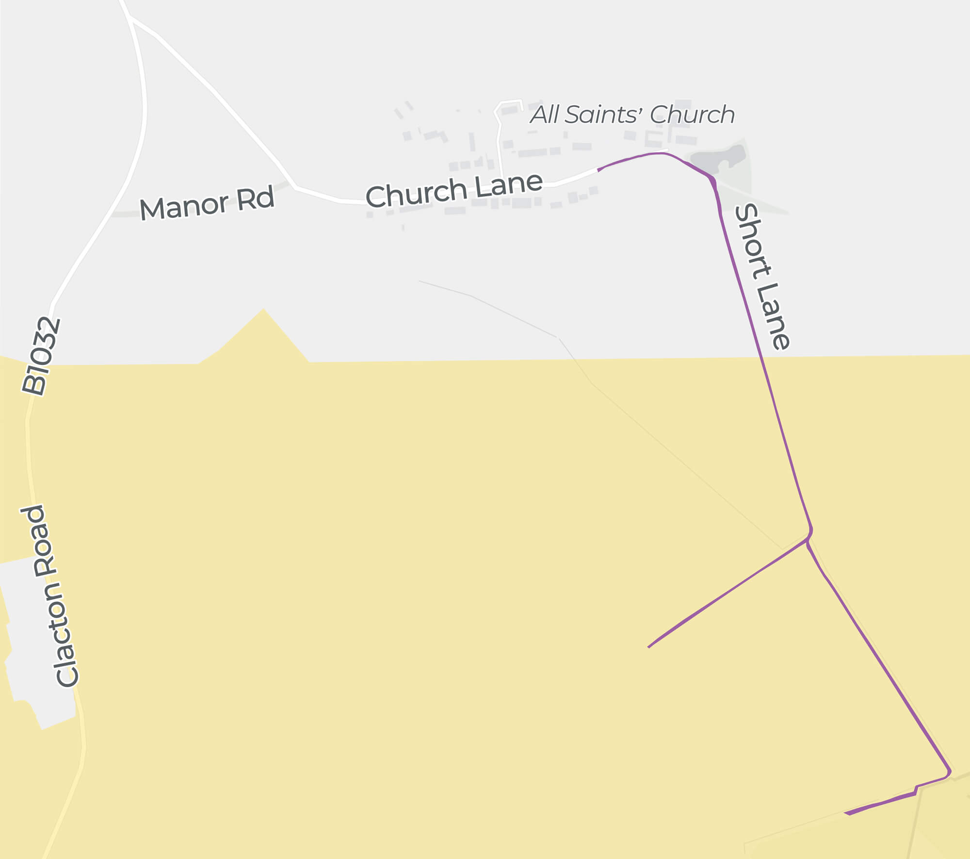
Click image to enlarge
Pinch to zoom
| 1 O&M Access Point Outside Onshore PEIR Boundary | |
|---|---|
| Location | Fields south of Short Lane. |
| Description | Creating access to landfall transition joint bays in the fields south of Short Lane using the southern fork and the fields north of Short Lane using the northern fork. |
| Rationale | To avoid interference with farm buildings south of the junction between the B1032 and Manor Road. Also to avoid a hedgerow immediately north of Short Lane. |
Click image to enlarge
Pinch to zoom
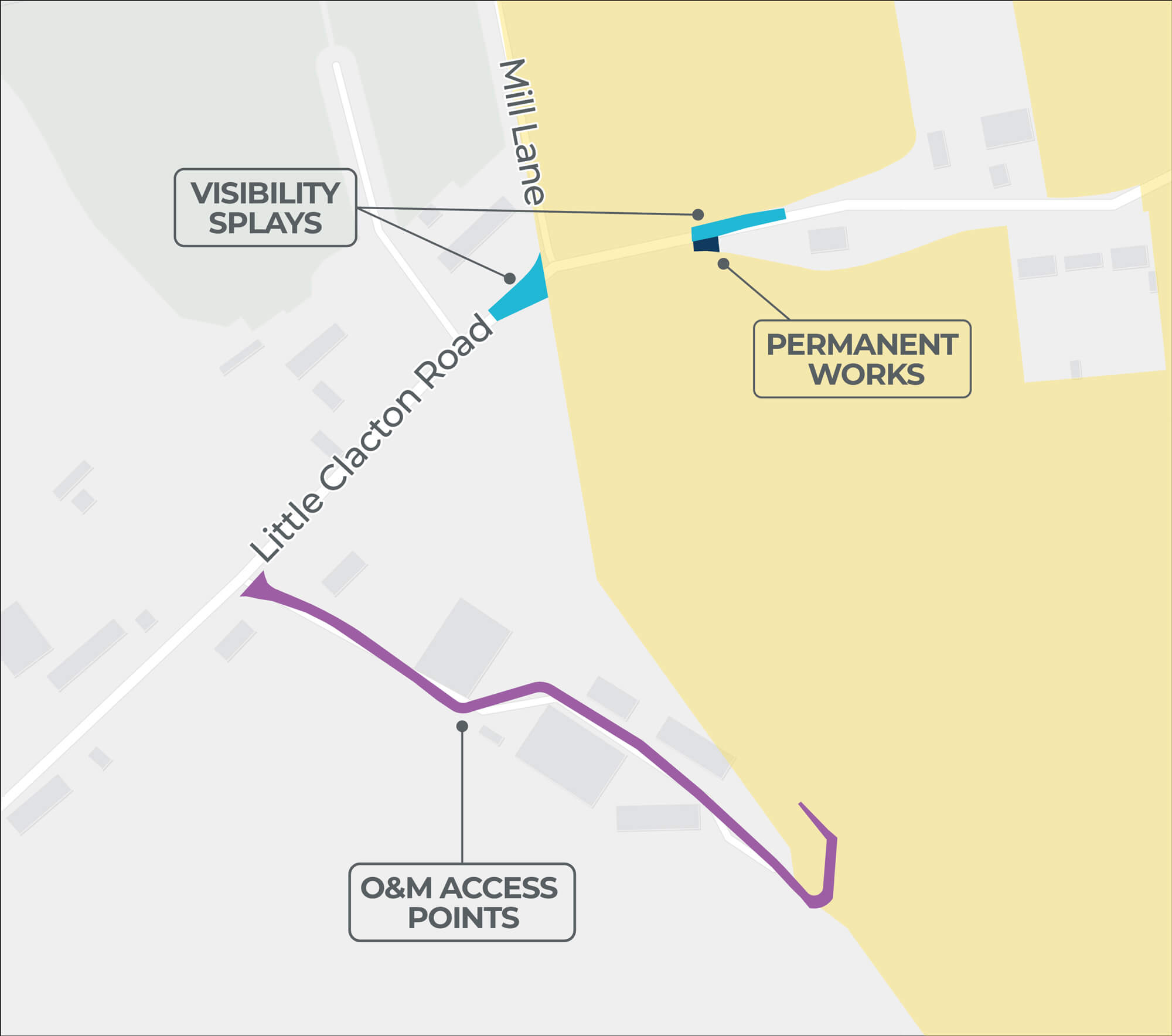
| 2 O&M Access Point Outside Onshore PEIR Boundary | |
|---|---|
| Location | Fields south of Little Clacton Road. |
| Description | Reduction of the length of cabling running through the farmstead. |
| Rationale | There is no direct access to the onshore cable corridor from the adjacent public highway. Creating a new road would involve removing a hedgerow and accessing a difficult area of Little Clacton Road due to limited visibility and an existing 60mph speed limit. A safer way to access the field is through the farmstead. Access to the field has been sought on both the eastern and western sides to mitigate possible effects on areas of cropping. |
Click image to enlarge
Pinch to zoom
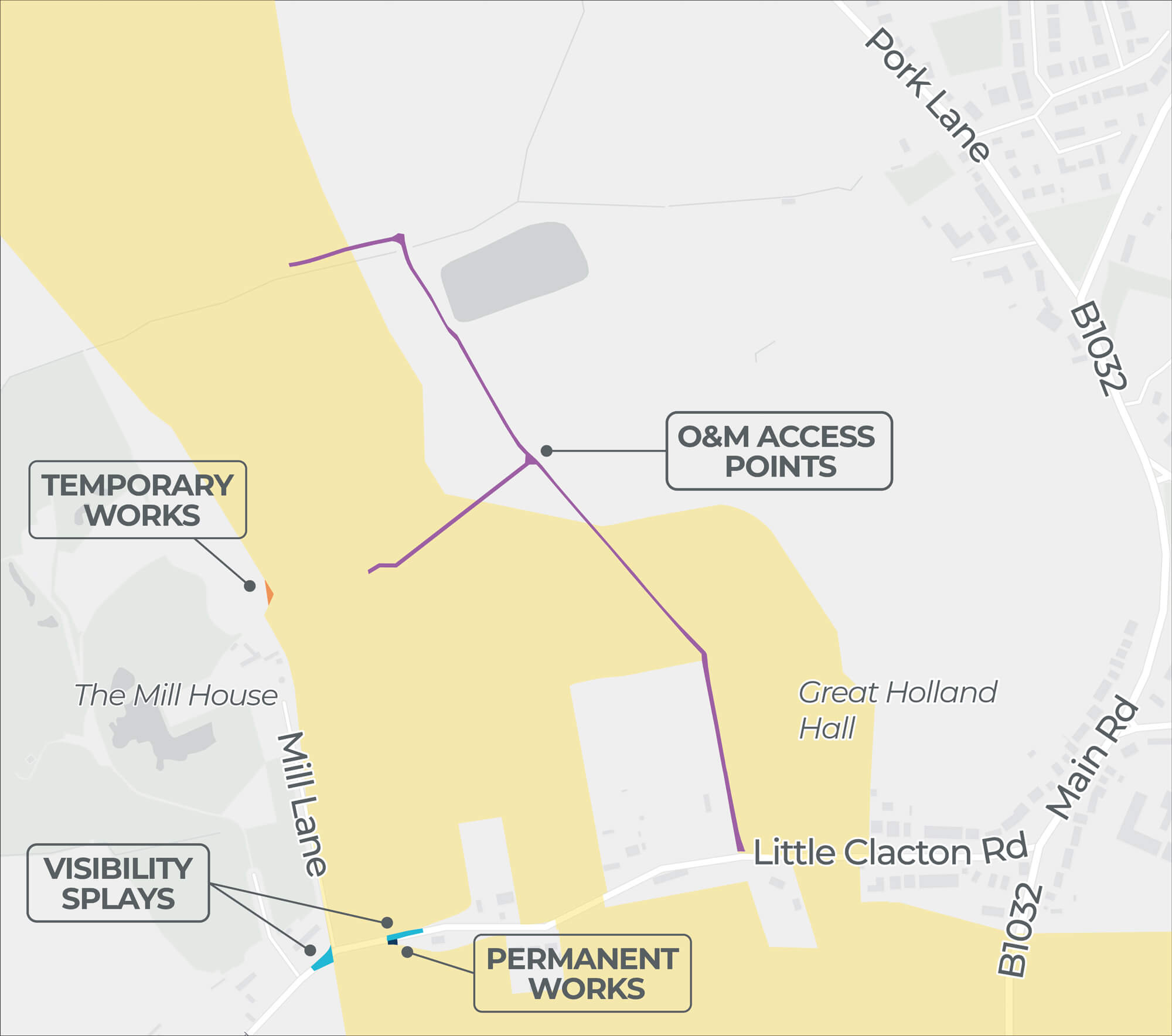
| 3 O&M Access Point Outside Onshore PEIR Boundary | |
|---|---|
| Location | North of Little Clacton Road. |
| Description | Creating access to the onshore cable corridor via fields north east and east of Great Holland Mill. |
| Rationale | There is no direct access to the onshore cable corridor from the public highway. Accessing via the onshore cable corridor would involve removing a hedgerow and accessing a difficult area of Little Clacton Road, due to the curved nature of the road limiting visibility, as well as its current 60mph speed limit. |
Click image to enlarge
Pinch to zoom
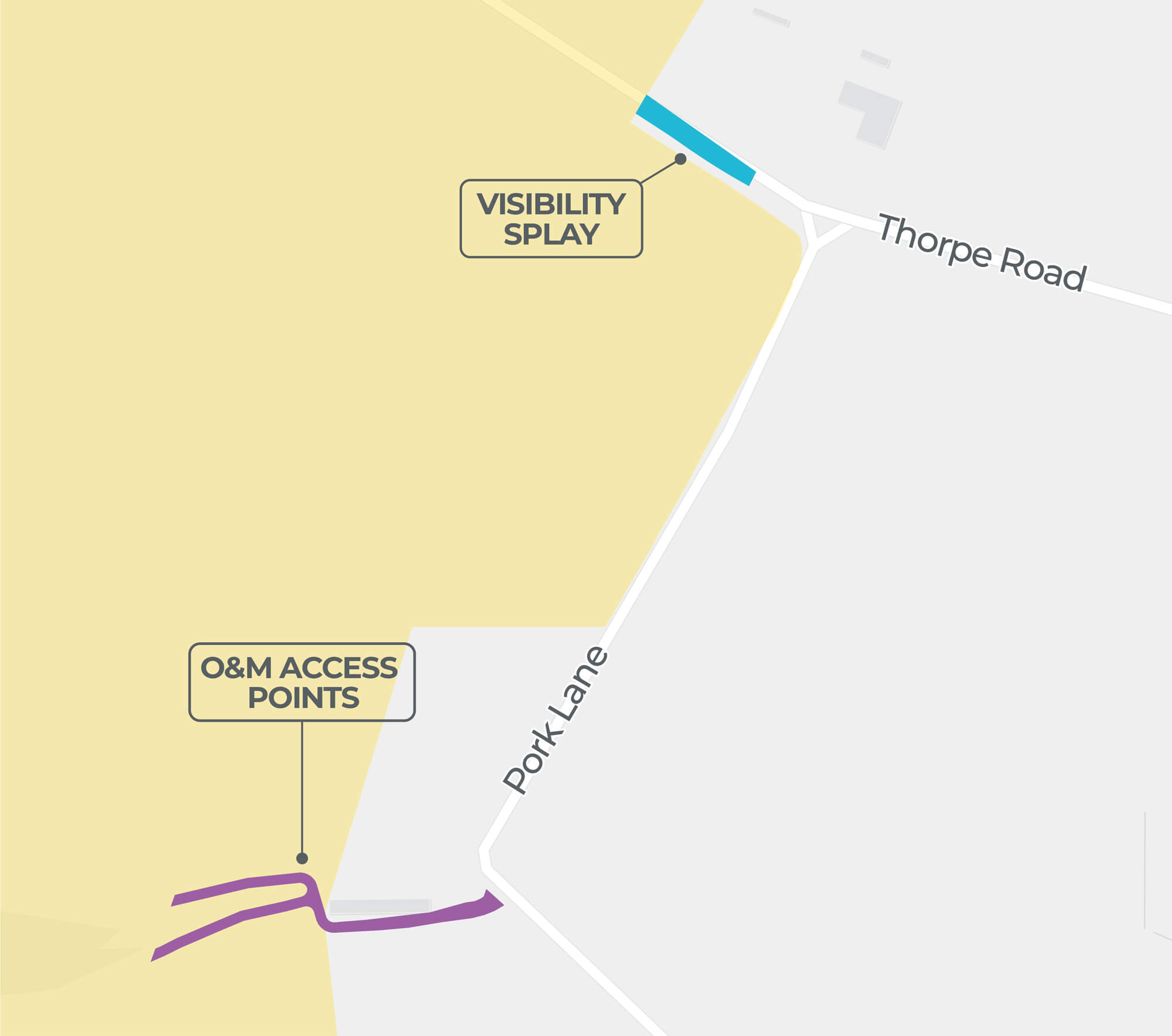
| 5 O&M Access Point Outside Onshore PEIR Boundary | |
|---|---|
| Location | Field west of Pork Lane. |
| Description | Extension of access required north of Little Clacton Road (as per O&M Access Point Outside Onshore PEIR Boundary – 3). |
| Rationale | As per rationale for O&M Access Point Outside Onshore PEIR Boundary – 3. There is also an additional hedgerow and a watercourse on the southern field boundary, which is a protected habitat. |
Click image to enlarge
Pinch to zoom
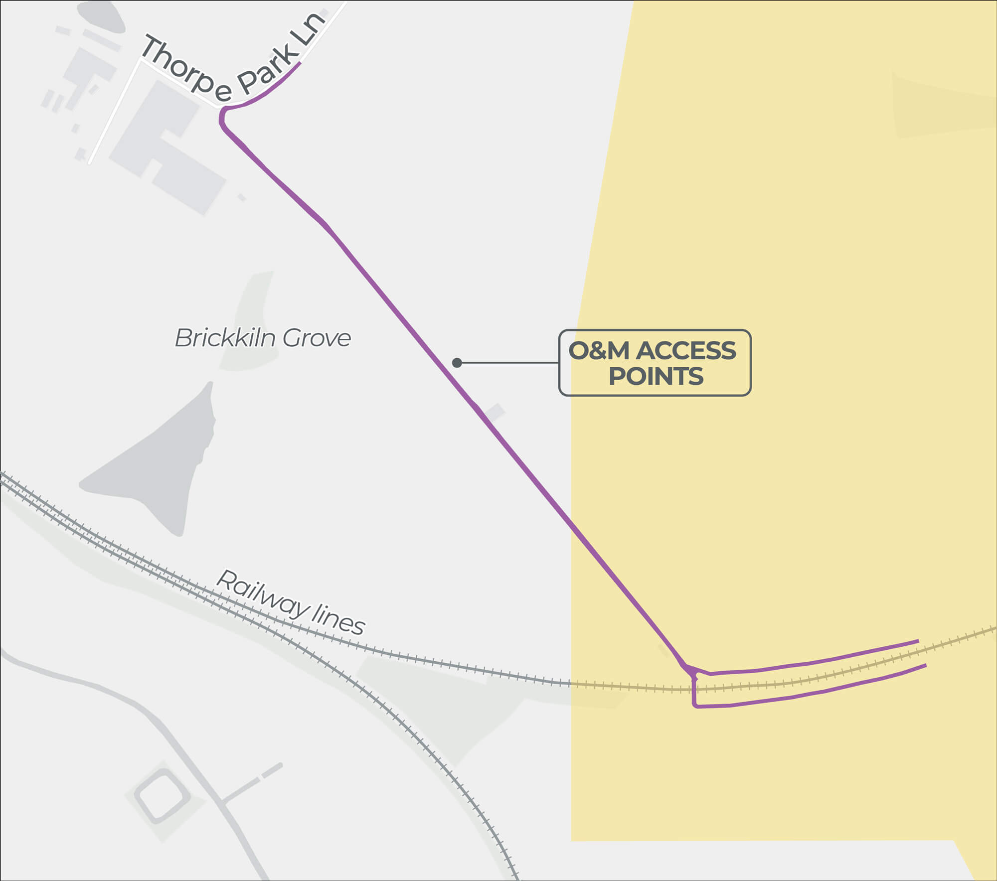
| 6 O&M Access Point Outside Onshore PEIR Boundary | |
|---|---|
| Location | Southern part of field north and field south of the railway (Sunshine Coast Line). |
| Description | Additional access to the onshore cable corridor from Thorpe Park Lane. |
| Rationale | Due to the field location and a watercourse and railway line, access to either side of the railway is constrained from an engineering and environmental perspective. This route allows for easier access to these fields and mitigates any potential effects on the land. |
Click image to enlarge
Pinch to zoom
| 7 O&M Access Point Outside Onshore PEIR Boundary | |
|---|---|
| Location | Fields west of Pork Lane. |
| Description | Allowing access to the onshore cable corridor via the northernmost part of the field north of the railway. |
| Rationale | This prevents the need to track across the field. Direct access from the B1033 could cause significant damage to the field and cropping areas. |
Click image to enlarge
Pinch to zoom
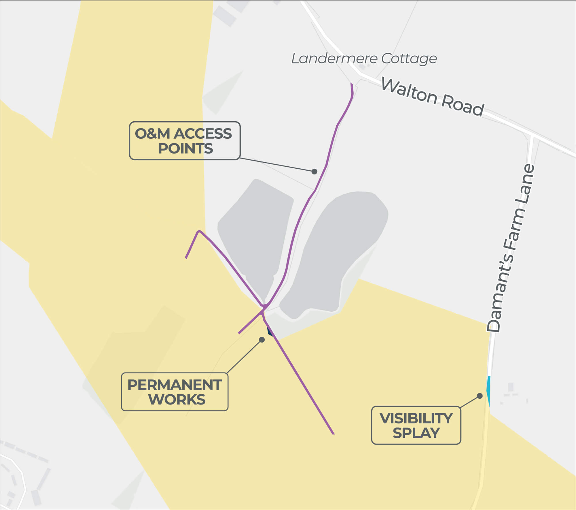
| 8 O&M Access Point Outside Onshore PEIR Boundary | |
|---|---|
| Location | South of Walton Road. |
| Description | Utilises an existing access to the onshore cable corridor. |
| Rationale | Direct access from the public highway to the onshore cable corridor would require the unnecessary removal of a hedgerow. |
Click image to enlarge
Pinch to zoom
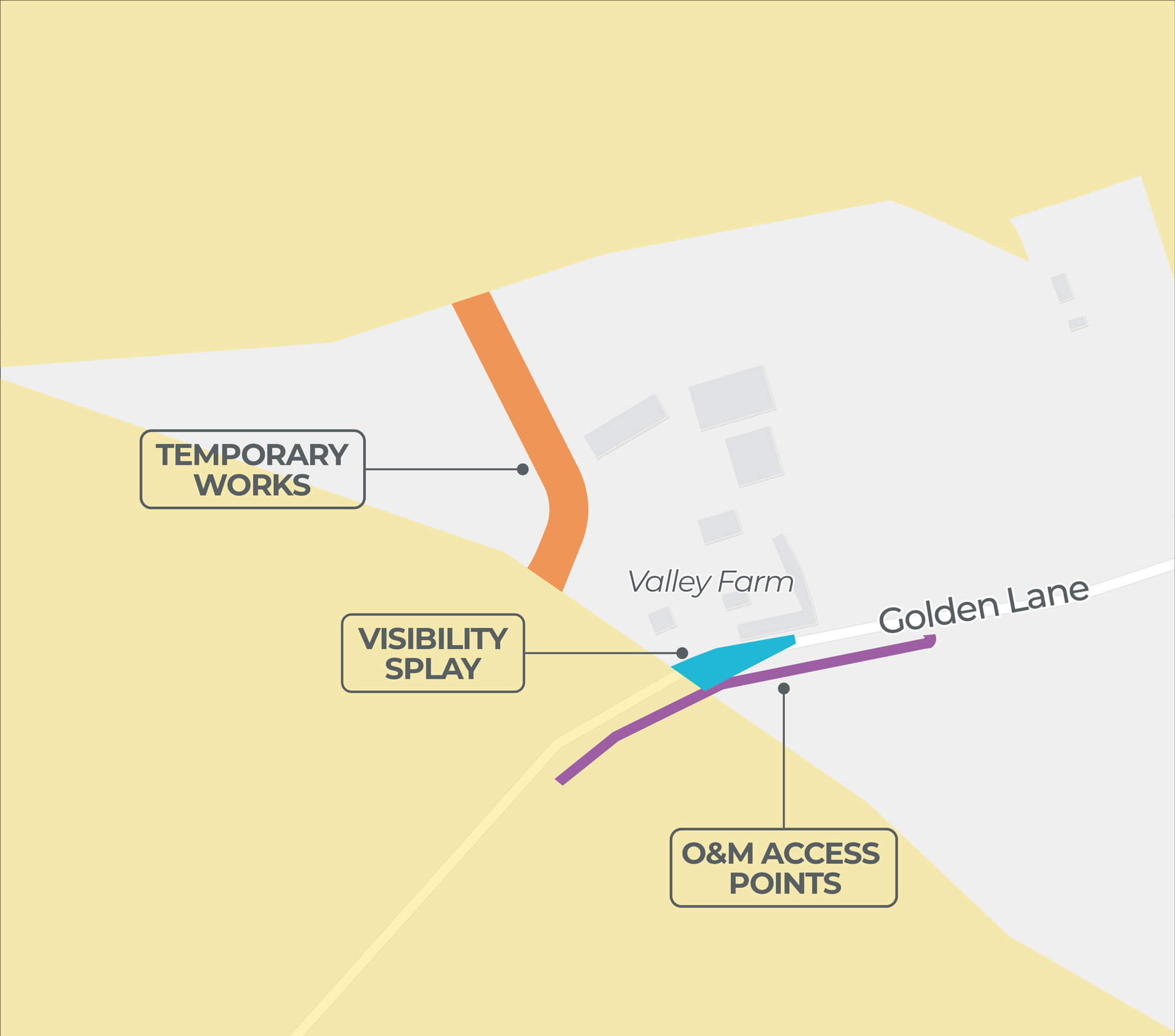
| 9 O&M Access Point Outside Onshore PEIR Boundary | |
|---|---|
| Location | Fields around Golden Lane. |
| Description | Utilises an existing access to the onshore cable corridor. |
| Rationale | Direct access from the public highway to the onshore cable corridor would require the unnecessary removal of a hedgerow. |
Click image to enlarge
Pinch to zoom
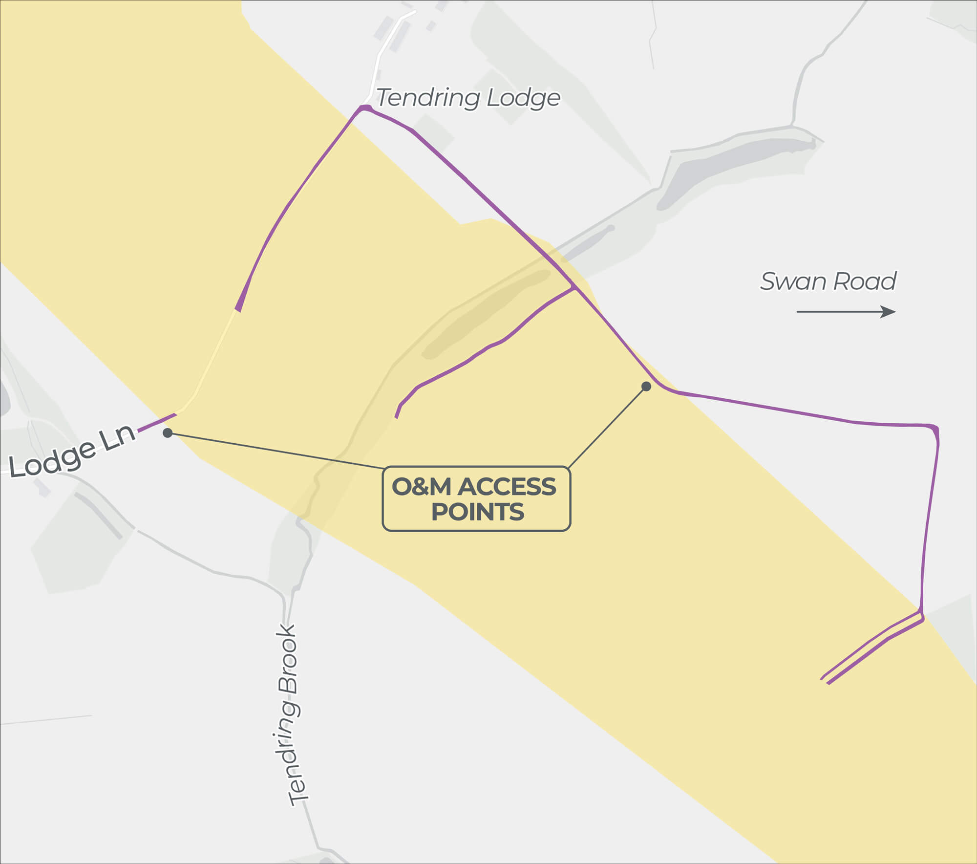
| 11 O&M Access Point Outside Onshore PEIR Boundary | |
|---|---|
| Location | Fields around Tendring Brook. |
| Description | Utilises existing access to the onshore cable corridor and an existing crossing of Tendring Brook. |
| Rationale | Alternative access to the field north of Tendring Brook would require tracking around the field boundary. |
Click image to enlarge
Pinch to zoom
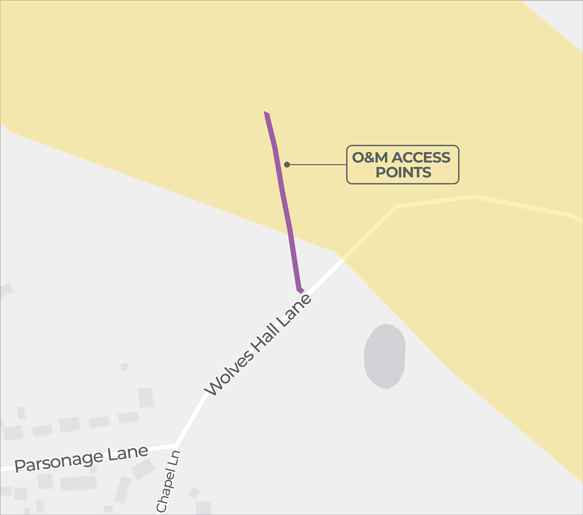
| 12 O&M Access Point Outside Onshore PEIR Boundary | |
|---|---|
| Location | Fields south of Wolves Hall Lane. |
| Description | Utilises an existing access to the onshore cable corridor. |
| Rationale | Due to the size of the field, access from Lodge Lane is required. Alternative accesses would be through the farmstead and across the field via Lodge Lane. |
Click image to enlarge
Pinch to zoom
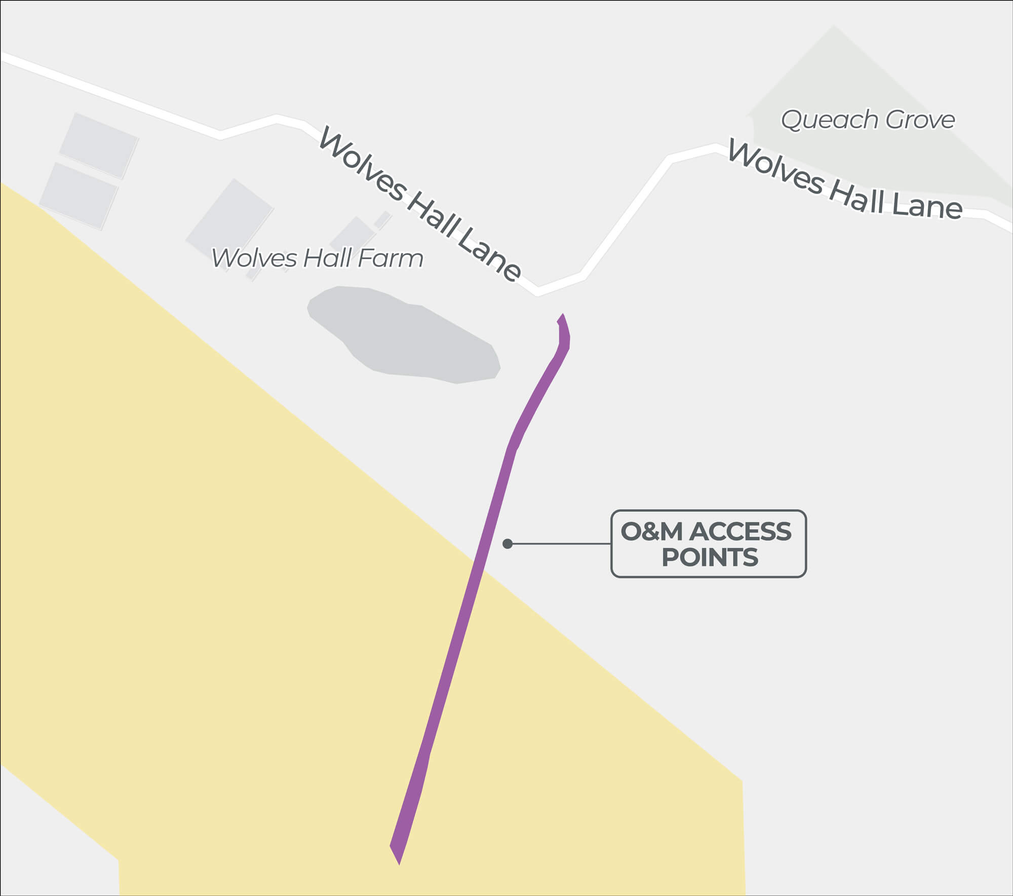
| 13 O&M Access Point Outside Onshore PEIR Boundary | |
|---|---|
| Location | Fields north of Wolves Hall Lane. |
| Description | Utilises an existing access to the onshore cable corridor. |
| Rationale | Direct access from the public highway to the onshore cable corridor would require the unnecessary removal of a hedgerow. |
Click image to enlarge
Pinch to zoom
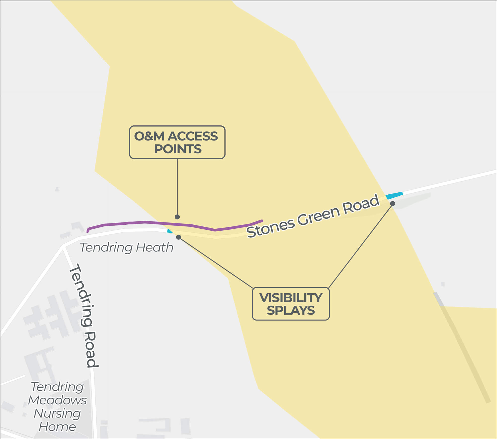
| 14 O&M Access Point Outside Onshore PEIR Boundary | |
|---|---|
| Location | Fields north of Stones Green. |
| Description | Utilises an existing access to the onshore cable corridor. |
| Rationale | Direct access from the public highway to the onshore cable corridor would require the unnecessary removal of a hedgerow. |
Click image to enlarge
Pinch to zoom
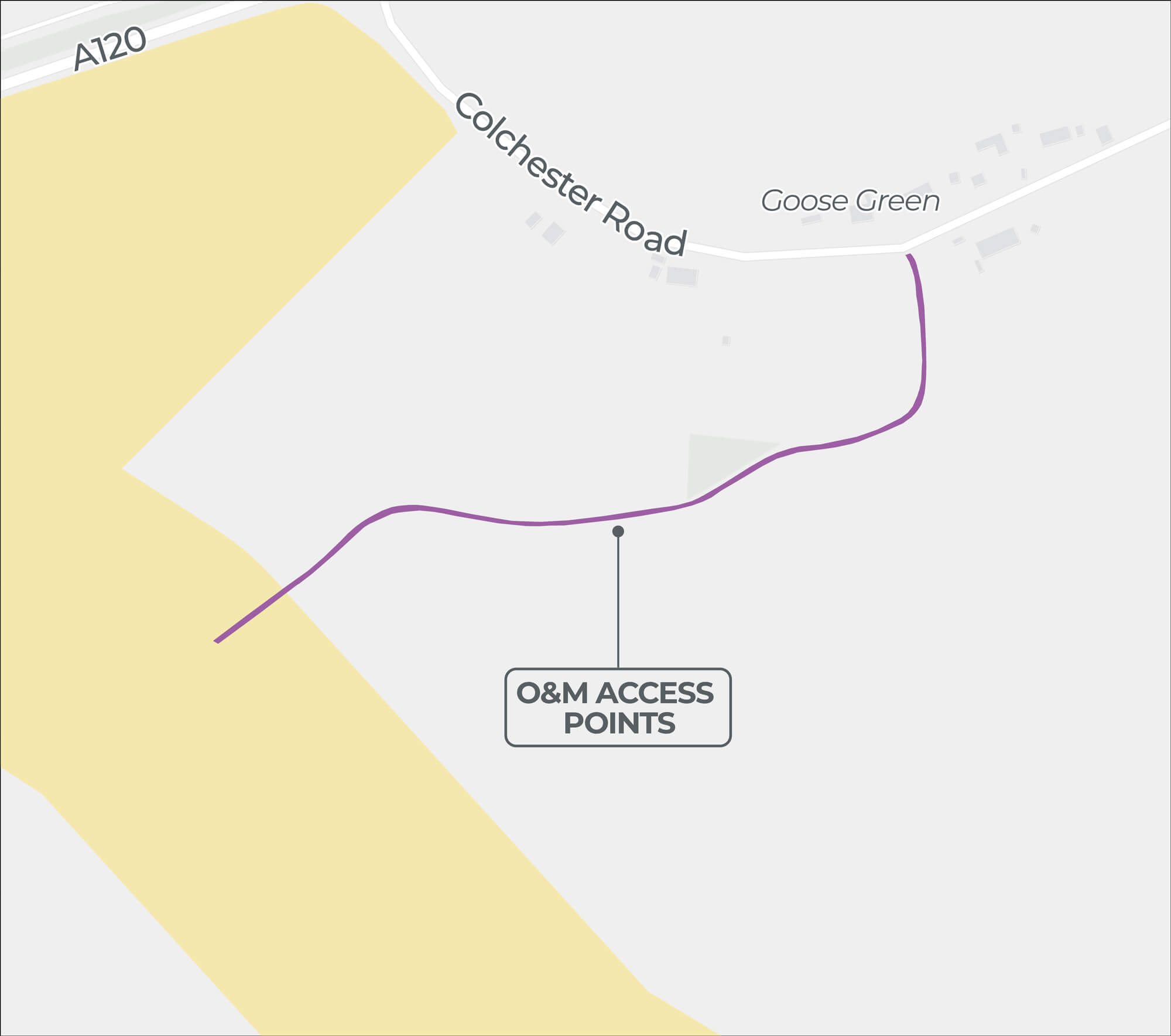
| 15 O&M Access Point Outside Onshore PEIR Boundary | |
|---|---|
| Location | Fields south of the A120. |
| Description | Utilises an existing access to the onshore cable corridor. |
| Rationale | Utilising the existing access is likely more safe than traffic accessing and leaving the field from the A120 and avoids disturbance to the operational farm in this area. |
Click image to enlarge
Pinch to zoom
| 18 O&M Access Point Outside Onshore PEIR Boundary | |
|---|---|
| Location | Field east of Bentley Road. |
| Description | Utilises an existing access to the onshore cable corridor |
| Rationale | Access direct from the public highway to the onshore cable corridor would require the unnecessary removal of a hedgerow. |
Do you want to keep up to date?
Please register your contact details with us if you would like to be kept informed about our project.