Indicative image of an offshore wind farm. North Falls’ design may differ
Onshore Cable Corridor Adjustments
A number of localised changes to the Project’s onshore cable corridor are proposed to accommodate the cable route at Little Clacton Road, south of Walton Road, north of Tendring Road and between Barlon Road and Spratts Lane.
These adjustments will also enable access to proposed temporary construction haul roads required to build the Project.
The maps shown below include a description and rationale for the permanent works relating to the onshore cable route. These works will remain in place throughout the Project’s operational lifespan.
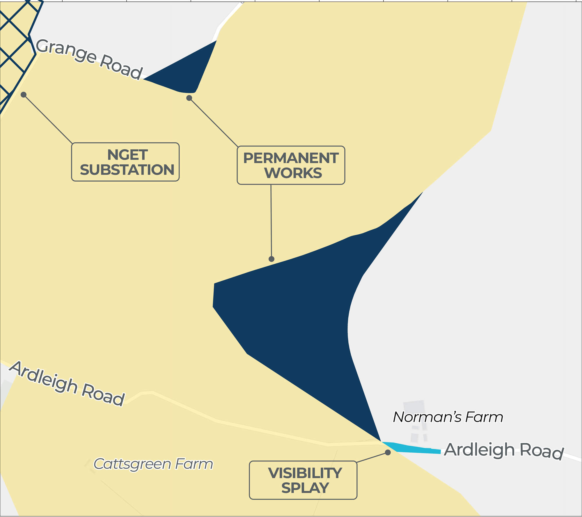
PERMANENT WORKS RELATING TO ONSHORE CABLE CORRIDOR
Click image to enlarge
Pinch to zoom
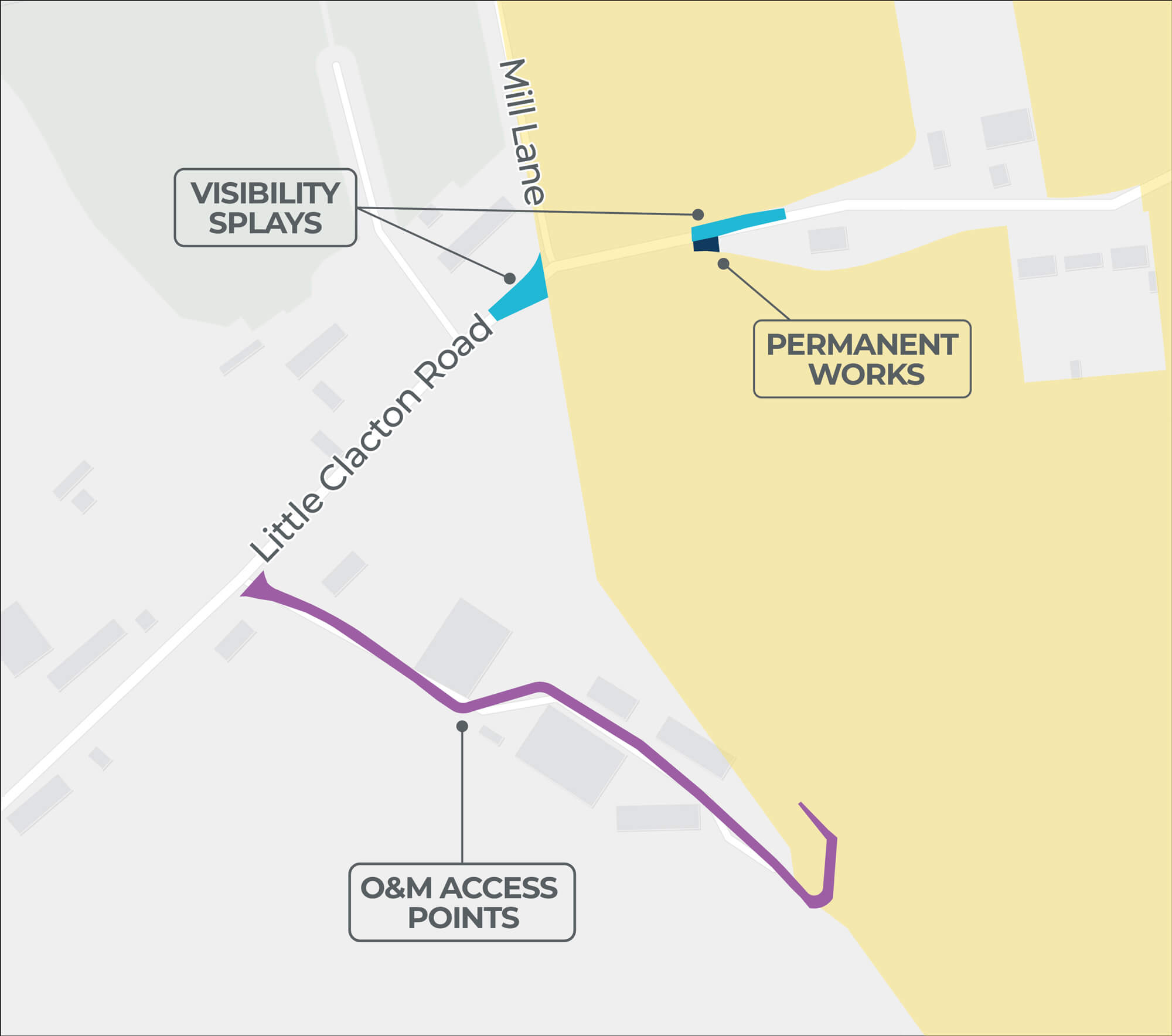
| 2 Onshore Cable Corridor Adjustment | |
|---|---|
| Location | Fields south of Little Clacton Road. |
| Description | Inclusion of a slightly wider area at the western crossing of Little Clacton Road. Other options previously considered for crossing Little Clacton Road have been removed. |
| Rationale | Using the additional eastern crossings of Little Clacton Road requires additional works, including further topsoil strips and temporary construction haul roads. This also helps to avoid potential archaeological features north of Little Clacton Road. |
Click image to enlarge
Pinch to zoom
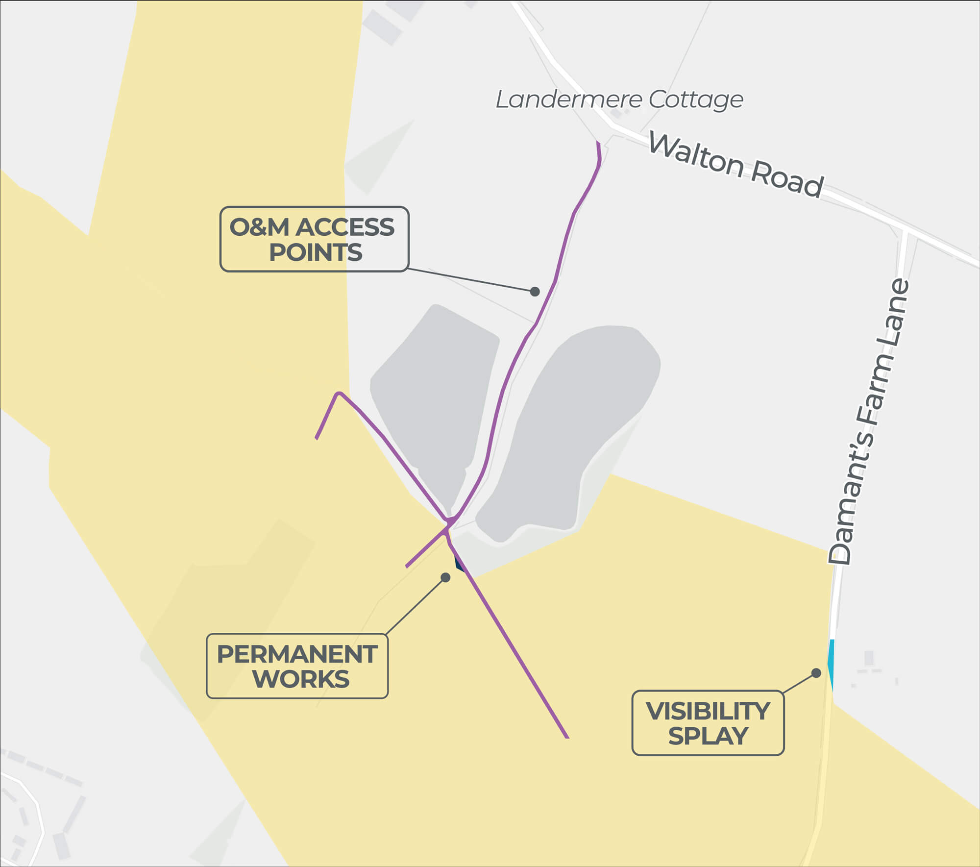
| 8 Onshore Cable Corridor Adjustment | |
|---|---|
| Location | South of Walton Road. |
| Description | Incorporated to prevent a small amount of land being severed between the O&M access point and onshore cable corridor in this area. |
| Rationale | Offers the potential to move the onshore cable corridor as close to nearby reservoirs as possible, therefore mitigating any potential effect on a nearby proposed housing development. |
Click image to enlarge
Pinch to zoom
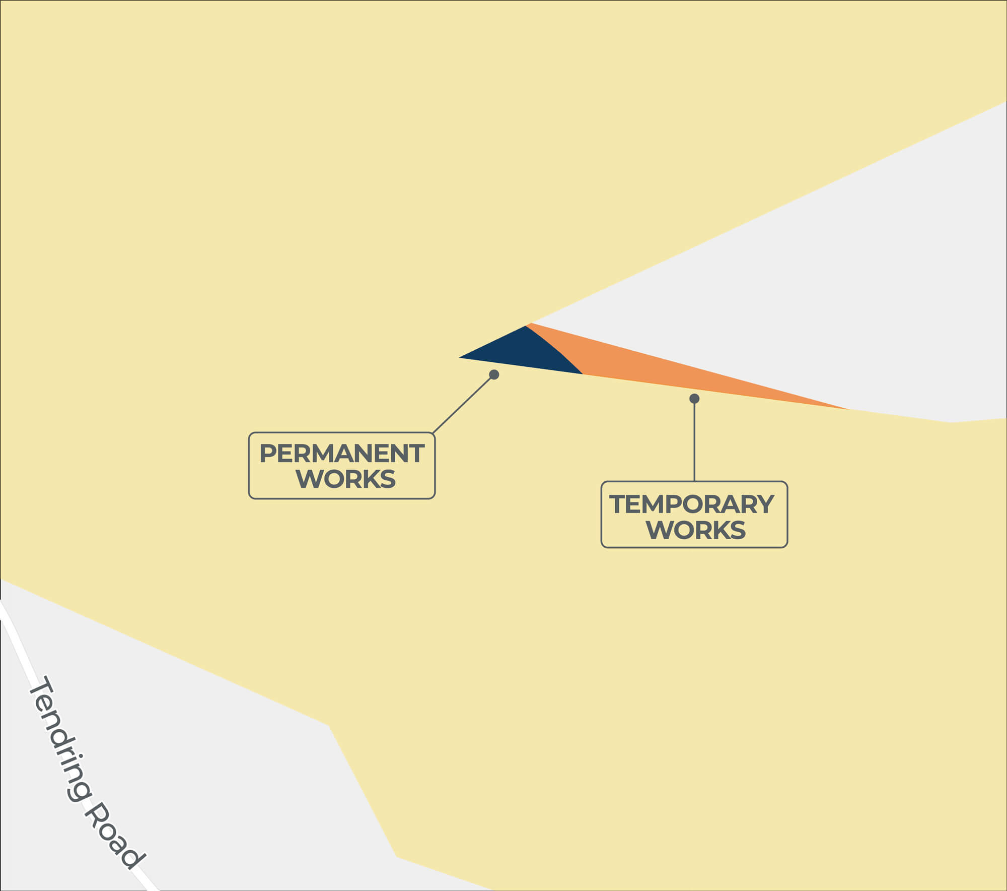
| 10 Onshore Cable Corridor Adjustment | |
|---|---|
| Location | North of Tendring Road. |
| Description | Moved further north, closer to the field boundary. |
| Rationale | Made as a result of feedback received saying to avoid mature trees to the south of the onshore cable corridor as far as possible. |
Click image to enlarge
Pinch to zoom
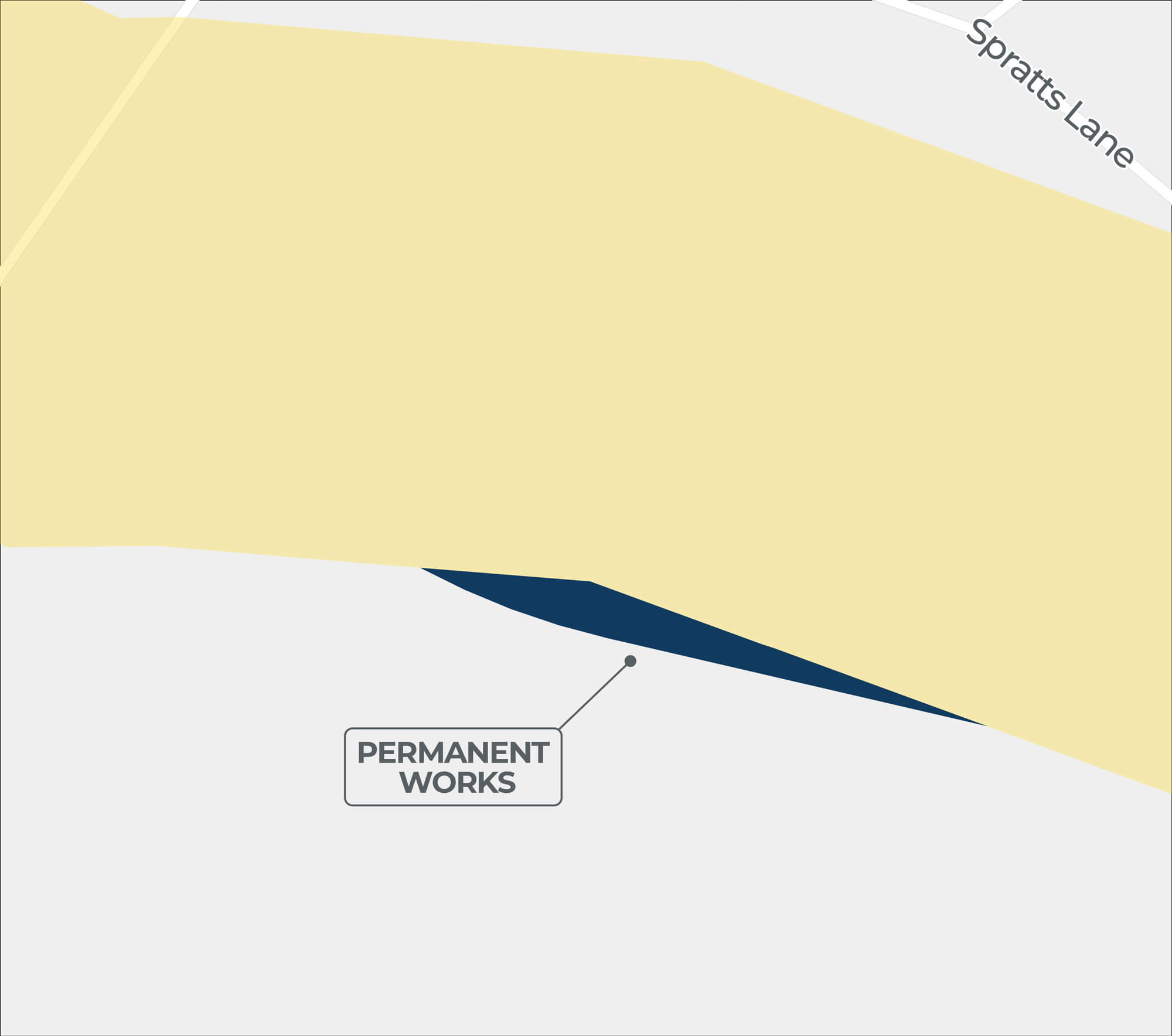
| 19 Onshore Cable Corridor Adjustment | |
|---|---|
| Location | Between Barlon Road and Spratts Lane. |
| Description | Moved further south. |
| Rationale | Avoids potential archaeological feature in the onshore cable corridor. |
Click image to enlarge
Pinch to zoom
| 20 Onshore Cable Corridor Adjustment | |
|---|---|
| Location | North Falls and Five Estuaries’ proposed co-located onshore substation zone. |
| Description | Incorporated to mitigate potential engineering constraints. |
| Rationale | As well as mitigating potential engineering constraints, this also enables coordination with Five Estuaries Offshore Wind Farm. |
Do you want to keep up to date?
Please register your contact details with us if you would like to be kept informed about our project.