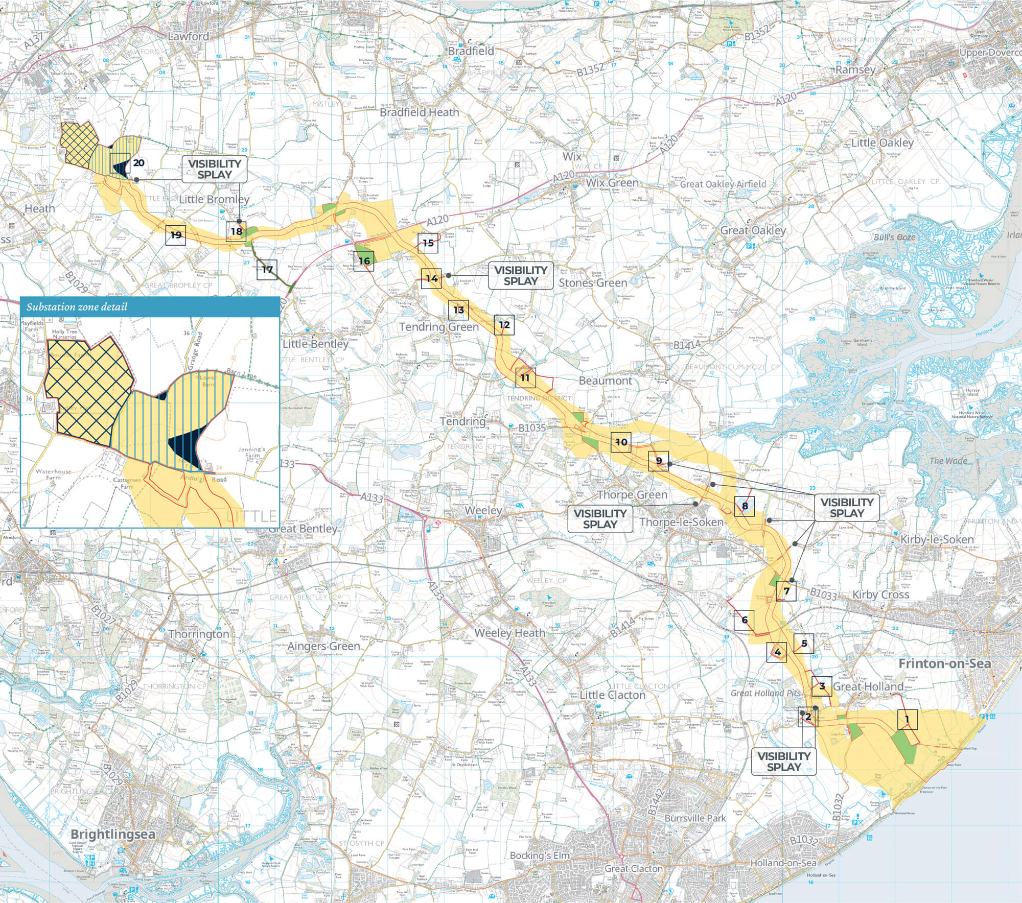
Onshore project area overview map
The map below provides an overview of the proposed localised changes to the Project’s onshore PEIR boundary. To help explain the proposals we’ve categorised and labelled each of the localised changes. Each category of localised change is also briefly summarised below. More information on each of these can be found in the PEIR Addendum.
The Project’s onshore PEIR boundary is coloured yellow on the overview map, and the Project’s proposed onshore DCO boundary is outlined in red.
- Operations and Maintenance (O&M) Access Points: There are 14 locations where O&M access points fall outside the onshore PEIR boundary. These are coloured purple.
- Temporary Construction Compounds (TCCs): 12 proposed locations for TCCs are located within the onshore PEIR boundary. These are coloured bright green.
- Bentley Road Improvements: Bentley Road is labelled number 17. More information can be found here.
- National Grid Connection Point: NGET’s East Anglia Connection Node is the grid connection for the Project and is labelled ‘National Grid Connection Point’.
- Visibility Splays: 11 visibility splays fall outside the onshore PEIR boundary. These are coloured bright blue.
- Adjustments to Onshore Cable Corridor: 10 adjustments to the onshore cable corridor are coloured dark blue.

Legend
To zoom in and view this map in more detail, you can view it as PDF.
View PDFAlternatively, you can use our interactive feedback map to view proposals in more detail and provide feedback on specific areas of our DCO boundary.
View interactive mapPermanent works relating to onshore cable corridor
Temporary works relating to construction haul roads
O&M access points
Fields south of Short Lane
Fields South of Little Clacton Road
North of Little Clacton Road
Field west of Pork Lane
Southern part of field north and field south of the railway (Sunshine Coast Line)
Fields west of Pork Lane
South of Walton Road
Fields around Golden Lane
Fields around Tendring Brook
Fields south of Wolves Hall Lane
Fields north of Wolves Hall Lane
Fields north of Stones Green
Fields south of the A120
Field east of Bentley Road
Do you want to keep up to date?
Please register your contact details with us if you would like to be kept informed about our project.
 North of Tendring Road
 Bentley Road
 Between Barlon Road and Spratts Lane
 North Falls and Five Estuaries’ proposed co-located onshore substation zone
 South of Railway Line (Sunshine Coast Line)
 South of the A120 / B1035 roundabout